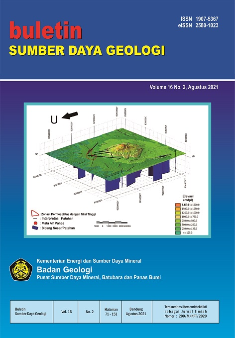
IDENTIFIKASI ZONA RESERVOAR PANAS BUMI BERDASARKAN ANALISIS FAULT FRACTURE DENSITY CITRA DIGITAL ELEVATION MODEL ALOS PALSAR DI GUNUNG RAJABASA
IDENTIFICATION OF GEOTHERMAL RESERVOIR ZONE BASED ON FAULT FRACTURE DENSITY ANALYSIS OF DIGITAL ELEVATION MODEL ALOS PALSAR IMAGE IN MOUNT RAJABASA
Abstrak
Gunung Rajabasa merupakan salah satu lapangan panas bumi di Sumatra yang belum dapat dieksploitasi hingga saat ini. Keberadaan manifestasi di daerah ini menjadi petunjuk keberadaan zona reservoar panas bumi. Penelitian ini bertujuan untuk mengidentifikasi zona permeabilitas tinggi berdasarkan analisis Fault Fracture Density (FFD) dan menganalisis keterkaitan antara karakteristik struktur jalur fluida panas bumi ke permukaan dengan lokasi zona reservoar panas bumi. Metode FFD dilakukan dengan menggunakan Citra Digital Elevation Model (DEM) ALOS PALSAR untuk memetakan kelurusan/lineament yang berasosiasi dengan zona patahan maupun rekahan khususnya di area manifestasi. Observasi struktur di lapangan dilakukan untuk mengkonfirmasi hasil FFD. Arah dominan dari struktur yang teridentifikasi sebagian selaras dan searah dengan sistem sesar Sumatra yaitu arah Barat Laut – Tenggara dan sebagian menunjukkan respons yang memotong sistem sesar utama. Selanjutnya, hasil analisis FFD menunjukkan keterkaitan yang cukup signifikan antara zona lemah (fracturing) dengan zona reservoar panas bumi yang ditunjukkan oleh pola densitas struktur tinggi pada zona upflow di manifestasi Way Belerang, sedangkan pada zona outflow di manifestasi mata air panas Gunung Botak berada pada densitas struktur yang rendah.
##plugins.generic.usageStats.downloads##
Referensi
Barber, A.J., Crow, M.J., Milsom, J.S., 2005. SUMATRA : Geology, Resources and Tectonic Evolution. The Geological Society, London.
Bronto, S., Asmoro, P., Hartono, G., Sulistiyono, S., 2012. Evolution of Rajabasa Volcano in Kalianda Area and Its Vicinity, South Lampung Regency. Indones. J. Geosci. 7, 11–25. https://doi.org/10.17014/ijog.v7i1.132
Budiardjo, B., Masdjuk, Leonardus, A.M.N., 1995. Detailed Geological report Rajabasa Mountain area, Lampung.
Bujung, C.A.N., Singarimbun, A., Muslim, D., Hirnawan, F., Sudradjat, A., 2011. Identifikasi prospek panas bumi berdasarkan Fault and Fracture Density ( FFD ): Studi kasus Gunung Patuha , Jawa Barat. J. Lingkung. dan Bencana Geol. 2, 67–75.
Chemong, C.A., Chenrai, P., 2013. Fracture density analysis in the sai yok fault, western thailand and its implications for hydrological exploration. Res. J. Appl. Sci. 8, 125–130. https://doi.org/10.3923/rjasci. 2013.125.130.
Darmawan, I.G.B., Setijadji, L.D., Wintolo, D., 2015. Geology and Geothermal System in Rajabasa Volcano South Lampung Regency, Indonesia (Approach to Field Observations, Water Geochemistry and Magnetic Method), in: Proceedings World Geothermal Congress.
Darmawan, I.G.B., Setijadji, L.D., Wintolo, D., 2013. Interpretasi Geologi Gunung Rajabasa Berdasarkan Integrasi Citra Aster, DEM dan Geologi Permukaan, in: Prosiding Seminar Nasional Kebumian Ke-6. hal. 285–298.
Das, A., Agrawal, R., Mohan, S., 2015. Topographic correction of ALOS-PALSAR images using InSAR-derived DEM. Geocarto Int. 30, 145–153. https://doi.org/10.1080/10106049.2014.883436.
Kusumasari, B.A., 2011. Geology surrounding areas Waymuli geochemical geothermal fluid in Mountain Rajabasa, South Lampung Regency, Lampung Province. Skripsi, Institut Teknologi Bandung.
Liu, J.G., Mason, P.J., 2013. Essential image processing and GIS for remote sensing, Essential Image Processing and GIS for Remote Sensing. wiley. https://doi.org/10.1002/9781118687963.
Mangga, S.A., Amirudin, Suwarti, T., Gafoer, S., Sidarto, 1993. Geological Map of Tanjungkarang, Sumatra. Geological Research and Development Centre, Bandung.
Rosenqvist, A., Shimada, M., Suzuki, S., Ohgushi, F., Tadono, T., Watanabe, M., Tsuzuku, K., Watanabe, T., Kamijo, S., Aoki, E., 2014. Operational performance of the ALOS global systematic acquisition strategy and observation plans for ALOS-2 PALSAR-2. Remote Sens. Environ. 155, 3–12. https://doi.org/10.1016/j. rse.2014.04.011.
Samsonov, S., 2010. Topographic correction for ALOS PALSAR interferometry. IEEE Trans. Geosci. Remote Sens. 48, 3020–3027. https://doi.org/10.1109/TGRS.2010.2043739.
Shimada, M., Itoh, T., Motooka, T., Watanabe, M., Shiraishi, T., Thapa, R., Lucas, R., 2014. New global forest/non-forest maps from ALOS PALSAR data (2007-2010). Remote Sens. Environ. 155, 13–31. https://doi.org/10.1016/j.rse.2014.04.014.
Suryantini, Wibowo, H., 2010. Application of Fault and Fracture Density (FFD) Method for Geothermal Exploration in Non-Volcanic Geothermal System; a Case Study in Sulawesi-Indonesia, in: Proceedings World Geothermal Congress 2010 Bali, Indonesia. hal. 1–9.
Tripp, G.I., Vearncombe, J.R., 2004. Fault/fracture density and mineralization: A contouring method for targeting in gold exploration. J. Struct. Geol. 26, 1087–1108. https://doi.org/10.1016/j.jsg.2003.11.002.
Whittle, M., Quegan, S., Uryu, Y., Stüewe, M., Yulianto, K., 2012. Detection of tropical deforestation using ALOS-PALSAR: A Sumatran case study. Remote Sens. Environ. 124, 83–98. https://doi.org/10.1016/j.rse.2012.04.027.
##submission.copyrightStatement##
##submission.license.cc.by-nc-sa4.footer##Penulis yang naskahnya diterbitkan menyetujui ketentuan sebagai berikut:
Hak publikasi atas semua materi naskah jurnal yang diterbitkan/dipublikasikan dalam situs Buletin Sumber Daya Geologi ini dipegang oleh dewan redaksi dengan sepengetahuan penulis (hak moral tetap milik penulis naskah).
Ketentuan legal formal untuk akses artikel digital jurnal elektronik ini tunduk pada ketentuan lisensi Creative Commons Attribution-ShareAlike (CC BY-SA), yang berarti Buletin Sumber Daya Geologi berhak menyimpan, mengalih media/format-kan, mengelola dalam bentuk pangkalan data (database), merawat, dan mempublikasikan artikel tanpa meminta izin dari Penulis selama tetap mencantumkan nama Penulis sebagai pemilik hak cipta.
Naskah yang diterbitkan/dipublikasikan secara cetak dan elektronik bersifat open access untuk tujuan pendidikan, penelitian, penyelidikan, dan perpustakaan. Selain tujuan tersebut, dewan redaksi tidak bertanggung jawab atas pelanggaran terhadap hukum hak cipta.


